Filters
Brands
Ordnance Survey (1123)
ProductsPro (31)
Garmin (14)
Casio (5)
Nicolson Digital Ltd (4)
Mairdumont (3)
Amazon Digital Services LLC - Kdp (3)
Natalia Kucirkova (1)
Motorola (1)
Mapseeker Archive Publishing (1)
Pathfinder (1)
Navitel (1)
Mapseeker Digital Ltd (1)
Springer-Verlag GmbH (1)
Cordee (1)
Binatone (1)
Brand Ordnance Survey (1)
Bandai Namco Entertainment (1)
MAIRDUMONT GmbH & Co. KG (1)
Amandeep Singh (1)
Price ranges
0 € - 13 € (639)
13 € - 17 € (545)
17 € - 7707 € (47)
Digital map data
1,137 result(s)
<
Previous page
26
27
28
29
30
Next page
>
Ordnance Survey Stornoway & North Lewis
View Product
Ordnance Survey Eastbourne, Hastings, Crowborough, Battle & Heathfield Os Landranger Active Map 199 (Waterproof)
View Product
Ordnance Survey Morpeth & Blyth - Ashington & Longframlington Os Explorer Active Map 325 (Waterproof)
View Product
Ordnance Survey Romney Marsh, Rye and Winchelsea
View Product
Ordnance Survey Glasgow - Paisley, Rutherglen & Kirkintilloch Os Explorer Active Map 342 (Waterproof)
View Product
Ordnance Survey Reading, Wokingham & Pangbourne Os Explorer Active Map 159 (Waterproof)
View Product
Ordnance Survey Thetford Forest in the Brecks
View Product
Ordnance Survey Northallerton, Ripon, Pateley Bridge & Leyburn Os Landranger Active Map 99 (Waterproof)
View Product
Ordnance Survey Shepton Mallet and Mendip Hills East
View Product
Ordnance Survey Thames Estuary, Rochester & Southend-On-Sea Os Landranger Active Map 178 (Waterproof)
View Product
Ordnance Survey Cardiff & Newport, Pontypool
View Product
Ordnance Survey Crewe & Nantwich - Whitchurch & Tattenhall Os Explorer Active Map 257 (Waterproof)
View Product
Ordnance Survey Southend-On-Sea & Basildon
View Product
Ordnance Survey Withernsea & Spurn Head Os Explorer Active Map 292 (Waterproof)
View Product
Ordnance Survey Glen Orchy, Loch Etive, Pateley Bridge & Leyburn Os Landranger Active Map 50 (Waterproof)
View Product
Ordnance Survey Kendal & Morecambe
View Product
Ordnance Survey Exeter & The Exe Valley - Crediton, Tiverton & Dulverton Os Explorer Active Map 114 (Waterproof)
View Product
Ordnance Survey Lincolnshire Wolds North - Louth & Market Rasen Os Explorer Active Map 282 (Waterproof)
View Product
Ordnance Survey Brighton, Lewes, Worthing, Horsham & Haywards Heath Os Landranger Active Map 198 (Waterproof)
View Product
Ordnance Survey Vale Of Clwyd - Rhyl, Denbigh & Ruthin Os Explorer Active Map 264 (Waterproof)
View Product
Ordnance Survey Ripon & Boroughbridge - Easingwold Os Explorer Active Map 299 (Waterproof)
View Product
Ordnance Survey Hereford and Ross-on-Wye
View Product
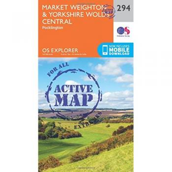
Ordnance Survey Market Weighton & Yorkshire Wolds Central - Pocklington Os Explorer Active Map 294 (Waterproof)
View Product
Ordnance Survey Rum, Eigg, Muck, Canna & Sanday Os Explorer Active Map 397 (Waterproof)
View Product
Ordnance Survey Edinburgh - Musselburgh & Queensferry Os Explorer Active Map 350 (Waterproof)
View Product
Ordnance Survey Blackpool & Preston - Lytham St Anne`S & Leyland Os Explorer Active Map 286 (Waterproof)
View Product
Ordnance Survey Ashford - Headcorn, Chilham & Wye Os Explorer Active Map 137 (Waterproof)
View Product
Ordnance Survey Chelmsford & The Rodings - Maldon & Witham Os Explorer Active Map 183 (Waterproof)
View Product
Ordnance Survey Clwydian Range, Prestatyn, Mold and Ruthin
View Product
Ordnance Survey Oswestry / Croesoswallt
View Product
Ordnance Survey Teviotdale South - Hawick Os Explorer Active Map 331 (Waterproof)
View Product
Ordnance Survey Peebles, Galashiels, Selkirk & Tweed Valley Os Landranger Active Map 73 (Waterproof)
View Product
Ordnance Survey Blackpool & Preston - Lytham St Anne`S & Leyland Os Explorer Map 286 (Paper)
View Product
Ordnance Survey March and Ely
View Product
Ordnance Survey The National Forest - Burton Upon Trent - Swadlincote Os Explorer 245
View Product
Ordnance Survey The National Forest Active
View Product
<
Previous page
26
27
28
29
30
Next page
>